WWWW 11.10.2006

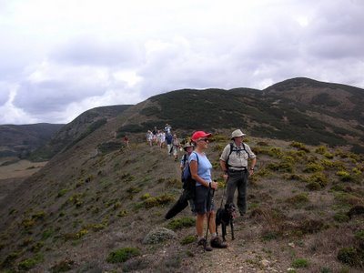
Doesn't look like rain over there - does it?
Leader: Antje (moral support - Chris)
Present: Myriam; Paul; Rod; Ian S.; David L.; John; Hazel; Gack; Peter; Janet; Carol, (Janet's sister); Tony (Janet's brother-in-law.)
Tiggy; Pooky; Brontus 
I am indebted to John for the rather succinct title above the picture; When we arrived at Café Bravo in Carrapateira after what (for the Algarve) was a torrential downpour, and which had caused a fairly unanimous decision to cut out the headland loop, and head straight for the cars, he remarked that it should be titled -"Wednesday Walkers' Whittle Wimpout" -. Hence the extra 'W's - and who am I to argue, as I was a distant second to Myriam in racing to the Café for sanctuary. Morale was restored by early beers/coffees/w.h.y. taken with our sandwiches under the capacious awnings of the café.
However the statistics do not lie, and even allowing for standard GPS reduction, we had only covered 11 km in 2 hrs 30 minutes walking time! This gave us a moving average of 4.5 km/hr, which is quite respectable, and also pointed at the lack of serious climbing. There must be a long one coming along soon to redress the balance, and to aid preparation for the RTC 2006 on 6/7th December.
I had mistakenly thought that we were going to do a close version of Ian C-S's walk which starts with a brisk walk up to the Tercenas TP, and involved a steep gorse scramble uphill, and had brought last year's Bamboo Diagram for update and amendment. When this didn't happen, I decided to record the 'Track' of the walk on the GPS and attempt to upload it onto a photo of the map of the area. You can view the result here.
The track we followed (or more accurately my right wrist followed) is the thin red line superimposed on the map. The picture can be magnified with the little symbol at the top right and then dragged to view. I was quite impressed with this, although in the absence of up to date paths on the map, it might not be as helpful with retracing the route as the Bamboo diagrams, or the track which is saved in my GPS.
The day had started with a thickish mist in the Lagos area which didn't begin to dispel until we were heading up north from Vila do Bispo. Then brilliant sunshine for the start, with no real indication of the clouds and rain which would move in, although Myriam claimed that the Portuguese radio weather report had predicted the same. It was actually quite warm along the first valley, and as we climbed up towards the 'new' hotel, which guards it's privacy jealously with numerous 'propriedade privado' signs, and a large dog kennel round the back where the dogs were taken to be watered. The breeze increased slightly as we reached the highpoint of the walk at 120 m. The west looked very grey, and as we were leaving Praia d'Amado, the rain started, and for the first time this season, out came the pacamacs, ponchos and plastic bin-liners - or not - if you had not followed your Boy Scout Training closely!
Luckily we had not started on the headland loop which would have been at least an extra hour, and Myriam led the charge to the Café, closely followed by myself, as I had the car keys.
Some of us had dry clothes, but it didn't matter as it soon stopped and I had wisely chosen the trousers with 'Dot Matrix' technology for enhanced drying!. Driving home, the roads near Lagos were almost dry, and Antje and Chris made it to the airport in good time for a pick-up, and Myriam and I took Xana to the vet, as she had been rather under the weather - and I bet you had been wondering why she wasn't on the walk!!


0 Comments:
Post a Comment
<< Home